



Maverick
GPS Navigation

Descrição do Maverick: GPS Navigation
Use offline maps and GPS even without an internet connection. This app is great for hiking, boating, geocaching and other outdoor activities.
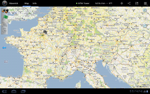
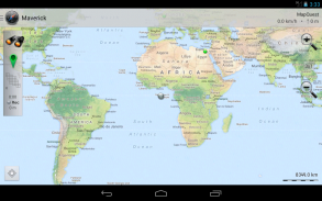
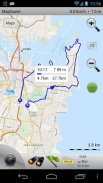
• Multiple global and regional online maps, including: Bing, Yandex, Open Street Maps, OSM Cycle, OSM Public Transport, Multimap (UK), OutdoorActive (Germany, Austria, South Tyrol), Cykloatlas, HikeBikeMap (Germany), Open Piste Map, NearMap (Australia) and many other maps.
All maps automatically cached for offline use. Use Mobile Atlas Creator to download maps or MAPC2MAPC to convert maps from other formats.
• Share your current or planned position
You can send address, GPS coordinates, link to Google Maps and even map image.
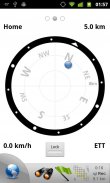
• Navigate easily
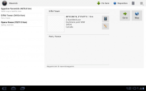
Build-in radar shows the direction, distance and estimated time to a point of interest.
• Save places you visit
All waypoint stored in KML file and can be viewed and edited in Google Earth.
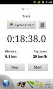
• Record tracks with single tap
Tracks are recorded in GPX format and can be viewed in Google Earth and other software.
• Upload tracks to GPSies
Free account is required for uploading.
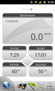
• Trip Computer
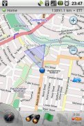
Watch speed, altitude, pitch and many other values.
Only in Pro version:
• Unlimited waypoints and tracks
• Lock compass to bearing
• UTM and OSGB grids
• OS Explorer maps
• FourSquare support
We can implement standard Google MapView, but it's limited - no caching and terrain view. If you need it, please email us or leave a comment.
</div> <div jsname="WJz9Hc" style="display:none">Use mapas offline e GPS, mesmo sem uma conexão com a internet. Este aplicativo é ótimo para caminhadas, passeios de barco, geocaching e outras atividades ao ar livre.
• Vários mapas on-line globais e regionais, incluindo: Bing, Yandex, Open Rua Maps, Ciclo OSM, OSM Transporte Público, Multimap (UK), OutdoorActive (Alemanha, Áustria, Tirol do Sul), Cykloatlas, HikeBikeMap (Alemanha), Open Piste Map , NearMap (Austrália) e muitos outros mapas.
Todos os mapas automaticamente armazenados em cache para uso off-line. Utilize o Mobile Atlas Creator para baixar mapas ou MAPC2MAPC para converter mapas de outros formatos.
• Partilhe a sua posição atual ou planejada
Você pode enviar endereço, coordenadas GPS, o link para o Google Maps e até mesmo mapa de imagem.
• Navegar facilmente
Construir-no radar mostra a direção, distância e tempo estimado para um ponto de interesse.
• Salvar lugares que você visita
Todos waypoint armazenado no arquivo KML e podem ser visualizados e editados no Google Earth.
• Grave as faixas com único toque
Faixas são gravados no formato GPX e pode ser visualizado no Google Earth e outros softwares.
• Carregar faixas para GPSies
Conta gratuita é necessário para fazer o upload.
• Computador de Bordo
Assista velocidade, altitude, terreno e muitos outros valores.
Apenas na versão Pro:
• Número ilimitado de waypoints e trilhas
• Bloqueio de bússola rolamento
• grades UTM e OSGB
• mapas OS Explorador
• apoio FourSquare
Podemos implementar padrão Google MapView, mas é limitado - sem cache e terreno vista. Se você precisar dele, por favor, um e-mail ou deixe um comentário.</div> <div class="show-more-end">


